$3,000.00 Original price was: $3,000.00.$2,500.00Current price is: $2,500.00.
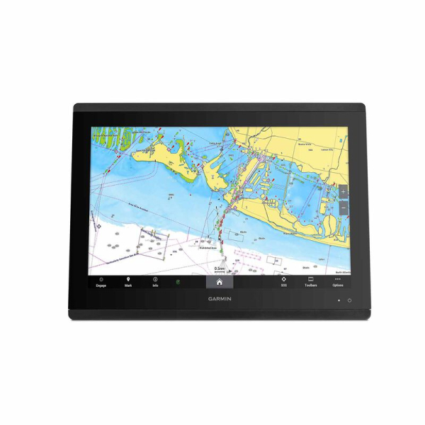
The Garmin GPSMAP 8617 is a marine chartplotter and multifunction display designed to bring navigation, sonar, networking and compatible onboard systems together at the helm. The supplied product information identifies a full HD IPS touchscreen, built-in Garmin Navionics inland and coastal mapping, Garmin Marine Network connectivity, NMEA 2000 and NMEA 0183 support, built-in sonar capabilities and wireless connectivity.
The GPSMAP 8617 is designed for installations where a central multifunction display is needed to coordinate navigation information with compatible radar, sonar, cameras, autopilot, digital switching, audio and other marine electronics.
The GPSMAP 8617 uses a full HD in-plane switching (IPS) touchscreen. The IPS display technology is designed to provide wider viewing angles and clear information at the helm, including when viewed from different positions or through polarized sunglasses.
The display can serve as a central interface for navigation and compatible connected systems. Multiple compatible Garmin displays can also be installed together to create a larger glass-helm arrangement.
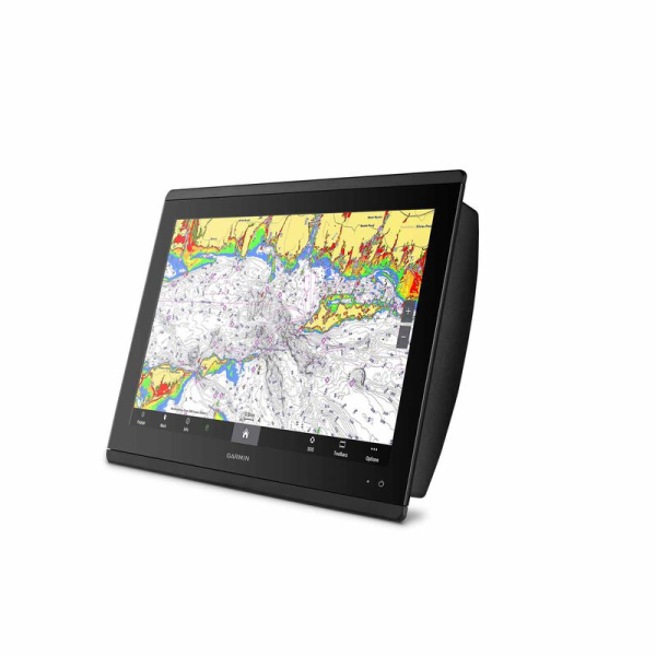
The product information identifies built-in Garmin Navionics inland and coastal mapping. Supported charting also includes Auto Guidance technology, while the listing describes a one-year subscription for downloadable daily updates and additional features on select chartplotters.
Optional Garmin Navionics Vision premium chart subscription capability is also identified, including features such as downloadable high-resolution relief shading, satellite imagery and sonar imagery. Chart availability and specific coverage depend on the selected chart products and operating region.
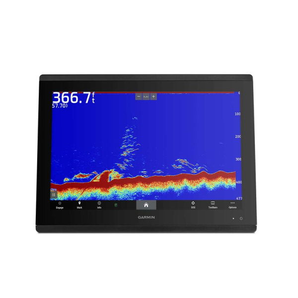
The GPSMAP 8617 provides built-in support for 1 kW dual-channel CHIRP traditional sonar. The product information states that this is designed to provide target separation when used with a compatible transducer.
The display also supports ClearVü and SideVü scanning sonar, with the supplied information identifying coverage of up to 1,000 feet below and around the boat at 260 kHz when a compatible transducer is installed.
Transducers are sold separately according to the product listing, so the correct transducer should be selected based on the intended sonar application and vessel installation.
The GPSMAP 8617 can be paired with compatible Garmin live sonar options. The source identifies live sonar support but specifies that the transducer is sold separately.
Live sonar equipment can provide real-time views around the boat when the required compatible hardware is installed. Confirm the exact transducer and network requirements before building a live-sonar system around the chartplotter.
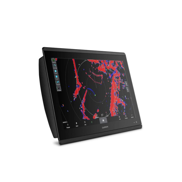
The GPSMAP 8617 is designed to work as part of a Garmin Marine Network. Compatible Garmin devices can share information such as maps, user data, radar and IP camera information across the network.
This makes the GPSMAP 8617 suitable for a connected helm where several Garmin marine electronics products need to exchange information rather than operating as isolated devices.
The product supports NMEA 2000 and NMEA 0183 networks. The listing identifies connections to equipment such as autopilots, digital switching, weather systems, FUSION-Link audio, VHF radios and AIS equipment.
Connecting these systems allows compatible information and controls to be accessed through the multifunction display. Installation requirements depend on the equipment being integrated and the network architecture of the vessel.
Built-in Wi-Fi connectivity works with the ActiveCaptain app, providing access to supported features such as OneChart, smart notifications, software updates, Helm functions and Garmin Quickdraw Community data.
The GPSMAP 8617 also includes integrated Bluetooth and ANT technologies. The source identifies compatibility with selected devices including quatix marine watches, gWind Wireless 2 transducers, GNX Wind marine instruments and compatible wireless remote controls.
SmartMode station controls provide quick access to connected system information from the multifunction display. The product information describes SmartMode as a way to bring networked sonar, radar, cameras, media and other systems into a coordinated helm interface.
This type of setup can be useful when different operating situations require different combinations of information, such as cruising, navigation or docking.
The OneHelm feature brings supported third-party marine equipment controls together on one screen. The supplied information specifically references EmpirBus digital switching as an example of compatible third-party integration.
Compatibility depends on the equipment installed on the vessel, so confirm supported devices before planning a OneHelm installation.
The GPSMAP 8617 supports the optional GRID 20 remote input device. The product information describes GRID 20 as a remote control for intuitive access to and control of a compatible Garmin marine system.
A remote control can be useful where the helm layout makes direct touchscreen access inconvenient or where multiple control positions are part of the vessel design.
For sailing applications, the GPSMAP 8617 provides Garmin SailAssist features. The supplied information identifies laylines, race-start line guidance, enhanced wind rose information, heading and course-over-ground lines, true wind data fields, tide/current/time slider information, wind angle, set and drift, wind speed and sailing polars.
Sailing polars can be used to compare expected vessel performance at different wind angles and speeds, helping the operator evaluate sail trim and sailing performance when the required data is available.
The GPSMAP 8617 can pair with a compatible inReach satellite communicator. The source describes sending custom messages from the chartplotter using the MFD’s on-screen keyboard, accessing contacts and grouping messages by conversation.
The satellite communicator is a separate device. Messaging availability depends on the compatible inReach hardware, service and coverage.
The GPSMAP 8617 is designed to be part of a broader marine electronics installation rather than functioning only as a standalone chartplotter. Before installation, identify the radar, sonar, transducers, autopilot, AIS, VHF, cameras, audio equipment and digital switching devices that need to connect to the system.
Plan the Garmin Marine Network, NMEA 2000 and NMEA 0183 connections in advance. Power, network cables, transducer wiring and mounting should all be planned around the final helm configuration.
| Feature | GPSMAP 8617 |
|---|---|
| Product type | Marine chartplotter / multifunction display |
| Display | Full HD IPS touchscreen |
| Mapping | Built-in Garmin Navionics inland and coastal mapping |
| Auto Guidance | Supported with compatible charting |
| Traditional sonar | 1 kW dual-channel CHIRP support |
| Scanning sonar | ClearVü and SideVü support |
| Scanning sonar coverage | Up to 1,000 ft at 260 kHz with compatible transducer |
| Live sonar | Compatible Garmin live sonar support |
| Marine networking | Garmin Marine Network |
| Boat networks | NMEA 2000 and NMEA 0183 |
| Wireless | Wi-Fi, Bluetooth and ANT |
| Mobile connectivity | ActiveCaptain |
| Remote control | Optional GRID 20 |
| Third-party integration | OneHelm support for compatible equipment |
The GPSMAP 8617 is suited to boat owners who want a connected multifunction display rather than a navigation screen that operates independently. Its mapping, sonar, networking and wireless features make it appropriate for vessels where several marine electronics systems need to be managed from one helm interface.
It can be considered for cruising, fishing and sailing installations, with the exact configuration determined by the compatible radar, sonar, transducers, autopilot, network equipment and other devices installed on the boat.
If you are comparing the GPSMAP 8617 with other marine GPS and chartplotter systems, consider screen technology, mapping coverage, sonar requirements, network connectivity, third-party integration and the equipment already installed on your vessel.
For questions about availability, compatibility or installation requirements, contact the Performance Engines team before ordering.
The GPSMAP 8617 is a marine chartplotter and multifunction display designed to integrate navigation with compatible sonar, radar, networking and other onboard systems.
Yes. The supplied product information identifies built-in Garmin Navionics inland and coastal mapping with supported Auto Guidance technology. Optional chart products and subscriptions are also available depending on the required coverage and features.
Yes. The product listing identifies built-in support for 1 kW dual-channel CHIRP traditional sonar and ClearVü and SideVü scanning sonar. Compatible transducers are sold separately.
Yes. Garmin Marine Network connectivity allows compatible devices to share information such as maps, user data, radar and IP camera information. The exact equipment supported depends on the installed Garmin system.
Yes. The product information identifies both NMEA 2000 and NMEA 0183 network support for connecting compatible autopilots, digital switching, weather equipment, audio, VHF, AIS and other marine electronics.
No. The supplied product information specifically states that transducers are sold separately. The correct transducer should be selected based on the intended traditional, scanning or live-sonar application.